
Understanding Soil Horizons: What’s Really Underneath Your Property?
Learn how natural soil layers (horizons O, A, B, C, R) form over centuries and why topsoil vs subsoil matters for your home and garden.
Soil horizons are distinct subterranean layers (topsoil, subsoil, weathered parent rock, bedrock) created over time by weathering, plant growth, and percolating water.
Visualizing Soil Horizon Formation & Water Movement
This three-stage visual sequence illustrates topsoil organic accumulation, downward water percolation, and the complete soil profile from topsoil to bedrock.
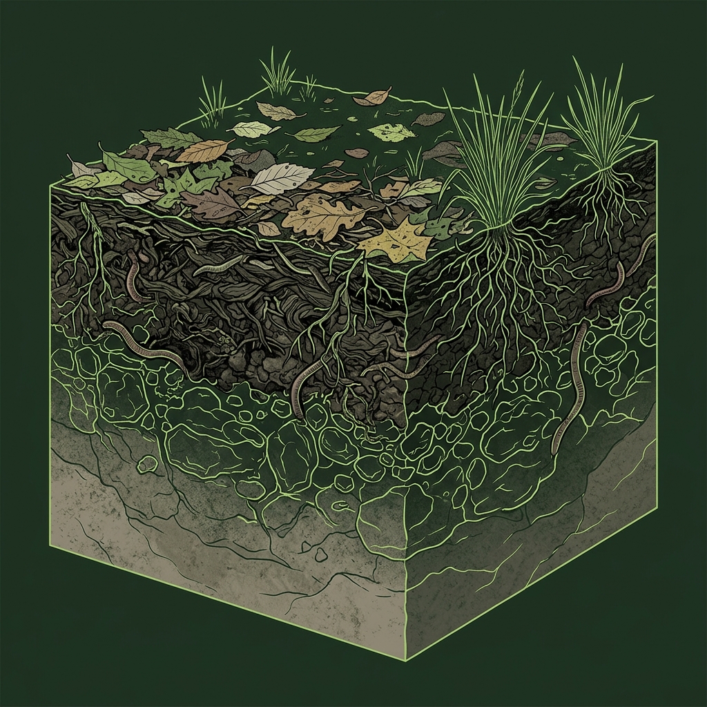
Organic Accumulation at the Surface
Fallen leaves, plant roots, earthworms, and biological life continuously decompose at the ground surface, creating a nutrient-rich, dark organic topsoil horizon.
What to notice: Notice how biological activity is heavily concentrated near the top layer.
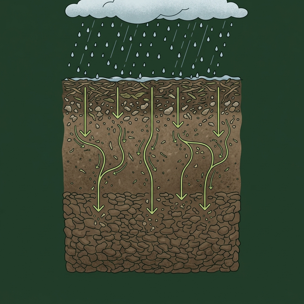
Water Transports Minerals Downward
Rainwater percolates through upper soil, dissolving minerals and washing fine clay particles downward into a denser, compact subsoil layer below.
What to notice: Downward water pathways gradually transform subsoil density and drainage.
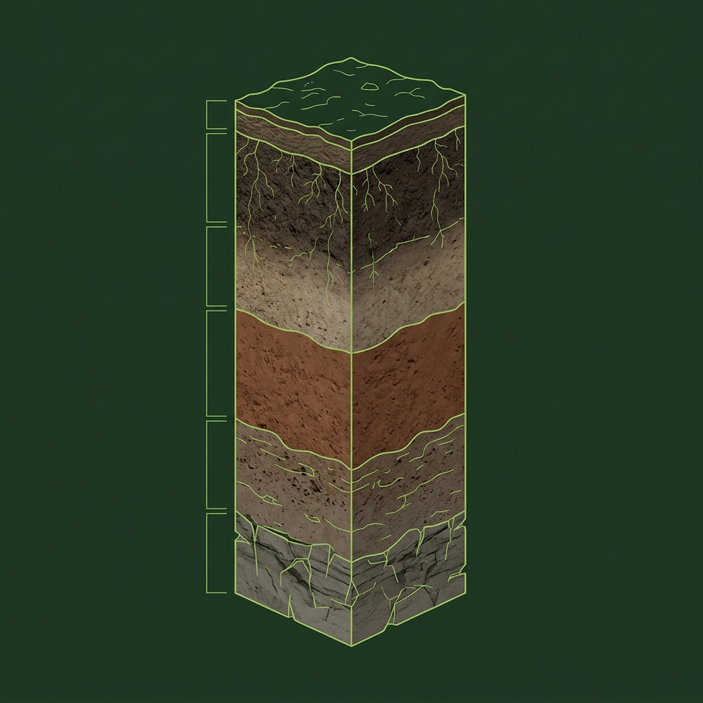
Stacked Horizons from Topsoil to Bedrock
Over thousands of years, distinct layers emerge: organic surface (O), dark topsoil (A), dense subsoil (B), weathered parent material (C), and solid bedrock (R).
What to notice: The thickness and depth of each horizon varies significantly by property location.
Key Takeaways
- Topsoil (A Horizon) is rich organic dirt where roots grow and beneficial earthworms thrive.
- B horizons can accumulate clay and minerals and can influence excavation conditions, water movement, and soil behavior; foundation suitability requires site-specific geotechnical evaluation.
- Parent Material (C Horizon) consists of weathered rock fragments without organic matter.
- Bedrock (R Horizon) forms the solid unweathered stone base deep underground.
The Earth as a Multi-Layered Sandwich
Soil is not uniform dirt beneath the surface. Over centuries, natural weathering and rainfall create distinct horizontal layers.
When you stand on a lawn, garden, or building lot, USDA records describe several stacked horizontal layers called Soil Horizons. Soil scientists label these layers using letters (O, A, B, C, R). Each horizon represents a distinct physical and chemical environment.
A horizon name is a scientific designation based on formation processes. Not every soil profile contains every named horizon (e.g. some lack E horizons or shallow bedrock), and transitions between layers in the field may be gradual rather than sudden lines.
Official USDA Field Explanation: Soil Horizons
Soil Horizon Depths & Designation
1. What is it? (Plain English)
The distinct natural horizontal layers (topsoil, subsoil, bedrock) stacked beneath the surface.
Technical definition: A layer of soil, approximately parallel to the soil surface, having distinct characteristics produced by soil-forming processes.
2. How USDA Reports This Field
chorizon.hznameInterpretation Ranges & Rating Meanings
| Category / Level | Condition / Range | Physical Property Meaning |
|---|---|---|
| Surface (O / A) | 0 to 30 cm depth | Organic litter and topsoil layer where biological activity and plant roots are concentrated. |
| Subsoil (B) | 30 to 120 cm depth | Accumulation layer collecting fine clays and minerals washed down by rainfall. |
| Substratum (C / R) | > 120 cm depth | Weathered parent material fragments or unweathered bedrock base. |
3. Why it matters for soil evaluation
Topsoil (A horizon) supports root growth, while compact subsoil (B horizon) influences water movement and excavation planning.
4. What This Field Does NOT Prove (Limitations)
- Horizon depths in mapped records represent soil-survey averages across a map unit polygon.
- Past site grading, land filling, or home construction can alter or remove upper topsoil horizons.
- Transitions between horizons in the field are often gradual rather than sudden lines.
USDA soil survey data provides broad mapped screening information across soil polygons. Field conditions on individual building lots can vary due to past grading, excavation, or micro-topography. Always consult a licensed geotechnical engineer or soil scientist for on-site parcel decisions.
How Horizons Appear in Subsurface Atlas Records
Subsurface Atlas extracts horizon depths and physical traits for every component listed in the USDA SSURGO survey, allowing you to examine subsoil clay and permeability layer by layer.
Property Relevance
Survey horizon records indicate typical subsoil clay layers, expected bedrock depths, and permeability across your mapped soil unit.
On-site excavation or hand auger sampling is required to confirm exact topsoil depth and subsoil compaction on your specific lot.
Survey Limitations & Notes
- Mapped horizon depths represent soil-survey averages across a map unit.
- Past site grading, land filling, or home construction can alter or remove upper topsoil horizons.
- Not every soil profile contains an E horizon or shallow bedrock.
Common Myths vs. Reality
Soil changes dramatically just 12 to 24 inches down in color, hardness, clay content, and water flow.
A rich 6-inch topsoil can rest right on top of a dense clay subsoil that holds standing water after every rain.
Primary Sources & References
Want to see what soil layers exist under your property?
Enter any U.S. address into Subsurface Atlas to explore mapped USDA soil units, components, drainage classes, and horizon profiles.
Run Address Lookup →