
Sand, Silt, and Clay: Soil Texture Classes Made Simple
Discover how particle sizes form soil texture classes like sand, silt, clay, and loam, and learn how texture influences moisture retention.
Soil texture describes the mix of particle sizes—coarse sand, silky silt, and microscopic clay—that give soil its feel and water-holding traits.
Visualizing Mineral Particle Sizes & Pore Geometry
This three-stage visual sequence illustrates coarse sand mineral pore space, fine clay particle pathways, and loamy soil mixtures.
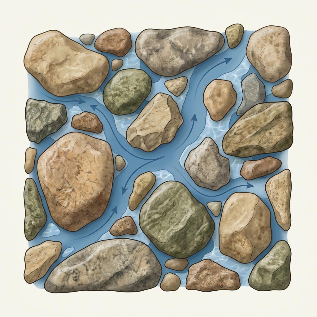
Broad Connected Sand Pore Spaces
Coarse sand particles create wide connected pore channels that allow water to drain rapidly with minimal moisture retention.
What to notice: Large mineral grains create broad inter-particle pathways.
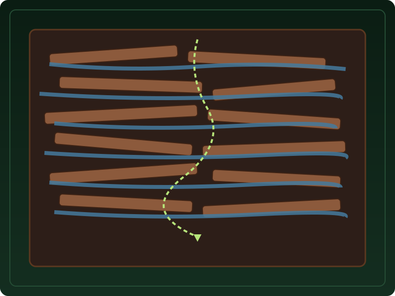
Plate-like Clay Minerals Hold Moisture
Microscopic clay minerals pack tightly together, creating narrow winding pathways that hold thin water films strongly around particle surfaces.
What to notice: Fine particle packing increases water film retention.
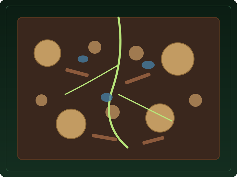
Balanced Sand, Silt, and Clay Mix
Loam describes a balanced mixture of sand, silt, and clay particles that holds moisture effectively while maintaining adequate root aeration.
What to notice: Loam combines drainage and water storage features.
Soil Texture Class Proportions
| Texture Class | Sand % | Silt % | Clay % |
|---|---|---|---|
| Sand | 85 to 100% | 0 to 15% | 0 to 10% |
| Loam | 30 to 50% | 30 to 50% | 7 to 27% |
| Clay | 0 to 45% | 0 to 40% | 40 to 100% |
Key Takeaways
- Sand particles are large and gritty; water drains through rapidly.
- Silt particles are medium-sized and feel smooth like flour.
- Clay particles are microscopic and sticky when wet, holding water and nutrients tightly.
- Loam is an ideal balanced blend of sand, silt, and clay.
Particle Size Differences
Soil texture is defined by relative proportions of sand, silt, and clay.
The physical feel and water storage of ground depend on particle size distribution. Sand particles are largest, silt is medium, and clay is microscopic.
Soil structure, compaction, restrictive layers, and seasonal saturation also influence water movement alongside particle percentages.
Official USDA Field Explanation: Soil Texture
Soil Texture Class & Particle Percentages
1. What is it? (Plain English)
The relative proportion of sand (coarse), silt (medium), and clay (microscopic) particles in a soil horizon.
Technical definition: The relative proportions of sand, silt, and clay particles in a mass of soil.
2. How USDA Reports This Field
chorizon.sandtotal_rInterpretation Ranges & Rating Meanings
| Category / Level | Condition / Range | Physical Property Meaning |
|---|---|---|
| Sandy Soils | > 70% Sand | Gritty texture, rapid drainage, low nutrient storage. |
| Loamy Soils | Balanced blend | Balanced texture for plant growth and moisture holding. |
| Clay Soils | > 35% Clay | Sticky when wet, hard when dry; holds water tightly but drains slowly. |
3. Why it matters for soil evaluation
Soil texture can influence how soil feels, stores nutrients and moisture, and responds to compaction alongside structure and management.
4. What This Field Does NOT Prove (Limitations)
- Texture alone does not determine drainage; soil structure, compaction, and restrictive layers also matter.
- Upper topsoil texture frequently differs from dense subsoil clay content.
USDA soil survey data provides broad mapped screening information across soil polygons. Field conditions on individual building lots can vary due to past grading, excavation, or micro-topography. Always consult a licensed geotechnical engineer or soil scientist for on-site parcel decisions.
How Soil Texture Appears in Subsurface Atlas Records
Subsurface Atlas extracts horizon particle percentages and texture designations.
Property Relevance
Screening context for soil workability, water storage, and lawn health.
On-site particle size testing is recommended for engineering design.
Survey Limitations & Notes
- Texture percentages reflect survey horizon samples across map units.
- Topsoil texture frequently differs from dense subsoil clay content.
Common Myths vs. Reality
Clay can retain nutrients and water, but plant response also depends on structure, drainage, chemistry, climate, and management.
Primary Sources & References
Want to see what soil layers exist under your property?
Enter any U.S. address into Subsurface Atlas to explore mapped USDA soil units, components, drainage classes, and horizon profiles.
Run Address Lookup →