
Soil Drainage Classes: From Excessively to Very Poorly Drained
Understand the seven USDA soil drainage classes and learn how historical wetness influences yards, lawns, and building foundations.
Soil drainage classes describe how long water stays in upper ground layers after heavy rain under natural conditions. Ratings range from Excessively Drained (dry sand) to Very Poorly Drained (permanently saturated ground).
Visualizing Soil Drainage & Wetness Positions
This three-stage visual sequence illustrates natural moisture movement across dry crests, balanced midslopes, and wet landscape depressions.
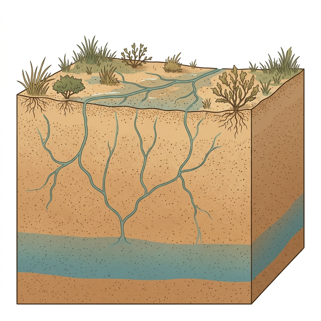
Rapid Downward Water Loss
In coarse sandy uplands, rainwater moves downward rapidly through wide pore spaces, leaving upper soil layers dry quickly after rain events.
What to notice: Notice how deep the seasonal water line rests beneath the surface.
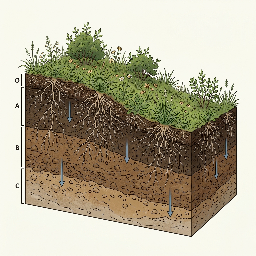
Balanced Soil Moisture Retention
Well-drained loamy soils remove excess surface water readily while retaining sufficient moisture within root zones for healthy plant growth.
What to notice: Water pathways divide evenly without shallow water accumulation.
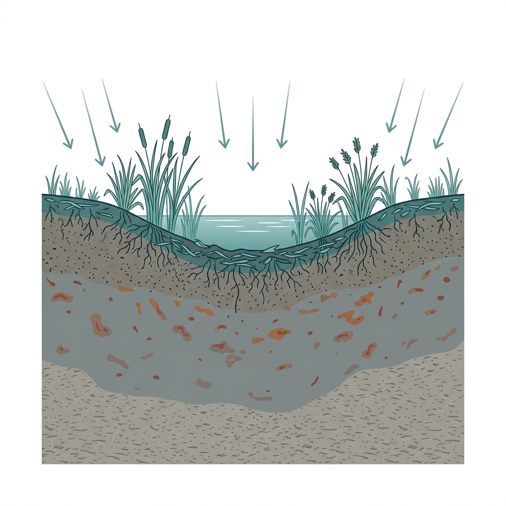
Frequent Surface Saturation
Low landscape depressions feature shallow water tables that remain saturated near the ground surface for extended periods during wet months.
What to notice: Muted gray soil matrices indicate oxygen-deprived wet conditions.
USDA Soil Drainage Classes Spectrum
Describes natural soil wetness and seasonal saturation duration under undeveloped conditions.
Key Takeaways
- USDA defines seven distinct natural soil drainage classes based on water table duration.
- "Well Drained" means water is removed readily without long-term saturation.
- "Poorly Drained" soils remain wet near the surface for extended periods during spring and winter.
- Artificial subsurface drainage or site grading changes wetness behavior.
Natural Soil Wetness Over Time
Drainage class measures how frequently and how long a soil stays wet under natural climate conditions.
When evaluating a parcel, USDA soil surveys categorize ground into seven natural Soil Drainage Classes. These classes describe natural soil wetness, not instantaneous infiltration rates.
"Well Drained" does not mean water always moves rapidly through deep clay horizons, and "Poorly Drained" does not mean a property is currently flooded.
Official USDA Field Explanation: Soil Drainage Class
Soil Drainage Class
1. What is it? (Plain English)
A survey description of how frequently and how long upper soil layers remain free of excess water under natural conditions.
Technical definition: Refers to the frequency and duration of wet periods under conditions similar to those under which the soil developed.
2. How USDA Reports This Field
component.drainageclInterpretation Ranges & Rating Meanings
| Category / Level | Condition / Range | Physical Property Meaning |
|---|---|---|
| Excessively Drained | Rapid water removal | Coarse porous sands where water is removed very rapidly. |
| Well Drained | Balanced water removal | Water is removed readily while retaining moisture available for plant growth. |
| Somewhat Poorly Drained | Seasonal wetness | Soil remains wet near the surface for significant periods during spring/winter. |
| Poorly / Very Poorly | Frequent saturation | Water is removed so slowly that the water table remains near the surface during growing seasons. |
3. Why it matters for soil evaluation
Provides general screening context for plant selection, lawn maintenance, and expected seasonal wetness.
4. What This Field Does NOT Prove (Limitations)
- Refers to natural undeveloped conditions; artificial subsurface drainage or ditches alter wetness.
- "Well Drained" does not guarantee water moves rapidly through all deeper subsoil horizons.
- Does not establish a legal wetland boundary or guarantee basement dry condition.
USDA soil survey data provides broad mapped screening information across soil polygons. Field conditions on individual building lots can vary due to past grading, excavation, or micro-topography. Always consult a licensed geotechnical engineer or soil scientist for on-site parcel decisions.
How Drainage Classes Appear in Subsurface Atlas Records
Subsurface Atlas maps the primary component drainage class for your searched location.
Property Relevance
Screening indicator for expected seasonal soil moisture and standing water behavior.
On-site test pits and topographical surveys determine specific drainage installation requirements.
Survey Limitations & Notes
- Mapped drainage classes describe natural undeveloped conditions.
- Subsurface tile drainage or urban stormwater sewers alter parcel wetness.
Common Myths vs. Reality
Heavy rain on compact topsoil can cause surface puddling even on well-drained soils.
Primary Sources & References
Want to see what soil layers exist under your property?
Enter any U.S. address into Subsurface Atlas to explore mapped USDA soil units, components, drainage classes, and horizon profiles.
Run Address Lookup →