
Shrink-Swell Soil and LEP: Understanding Soil Expansion Risks
Learn what Linear Extensibility Potential (LEP %) measures in USDA soil surveys and understand how expansive clay soils behave during wet and dry cycles.
Shrink-swell potential measures how much expansive clay soil expands when wet and shrinks when dry.
Visualizing Expansive Clay Shrink & Swell Cycles
This three-stage visual sequence illustrates dry soil contraction, wet expansion, and structural response.
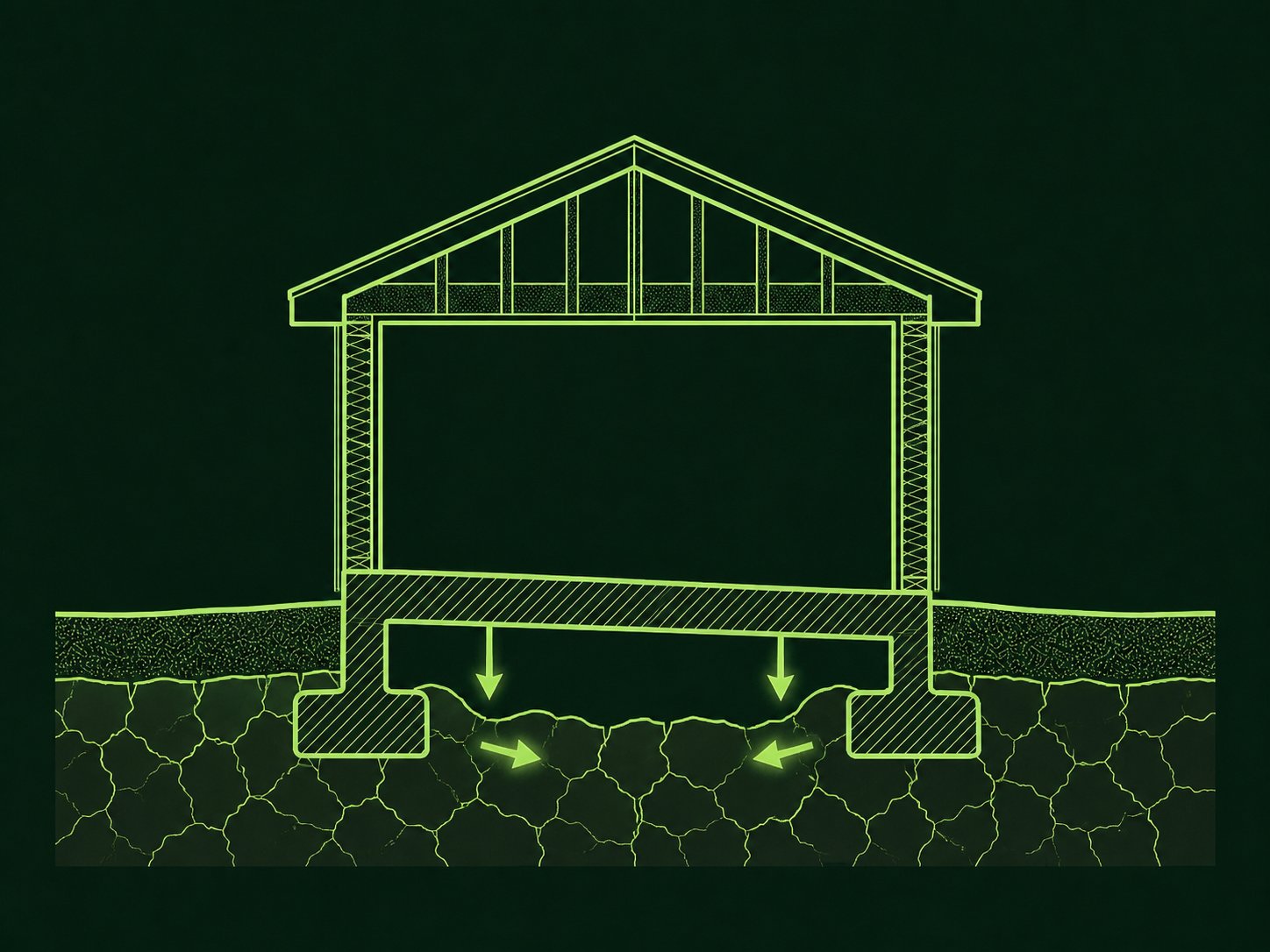
Volume Shrinkage During Dry Seasons
During dry periods, smectite clay minerals lose water between molecular sheets, causing upper soil layers to contract and form vertical surface cracks.
What to notice: Notice the vertical soil shrinkage gaps formed during dry conditions.
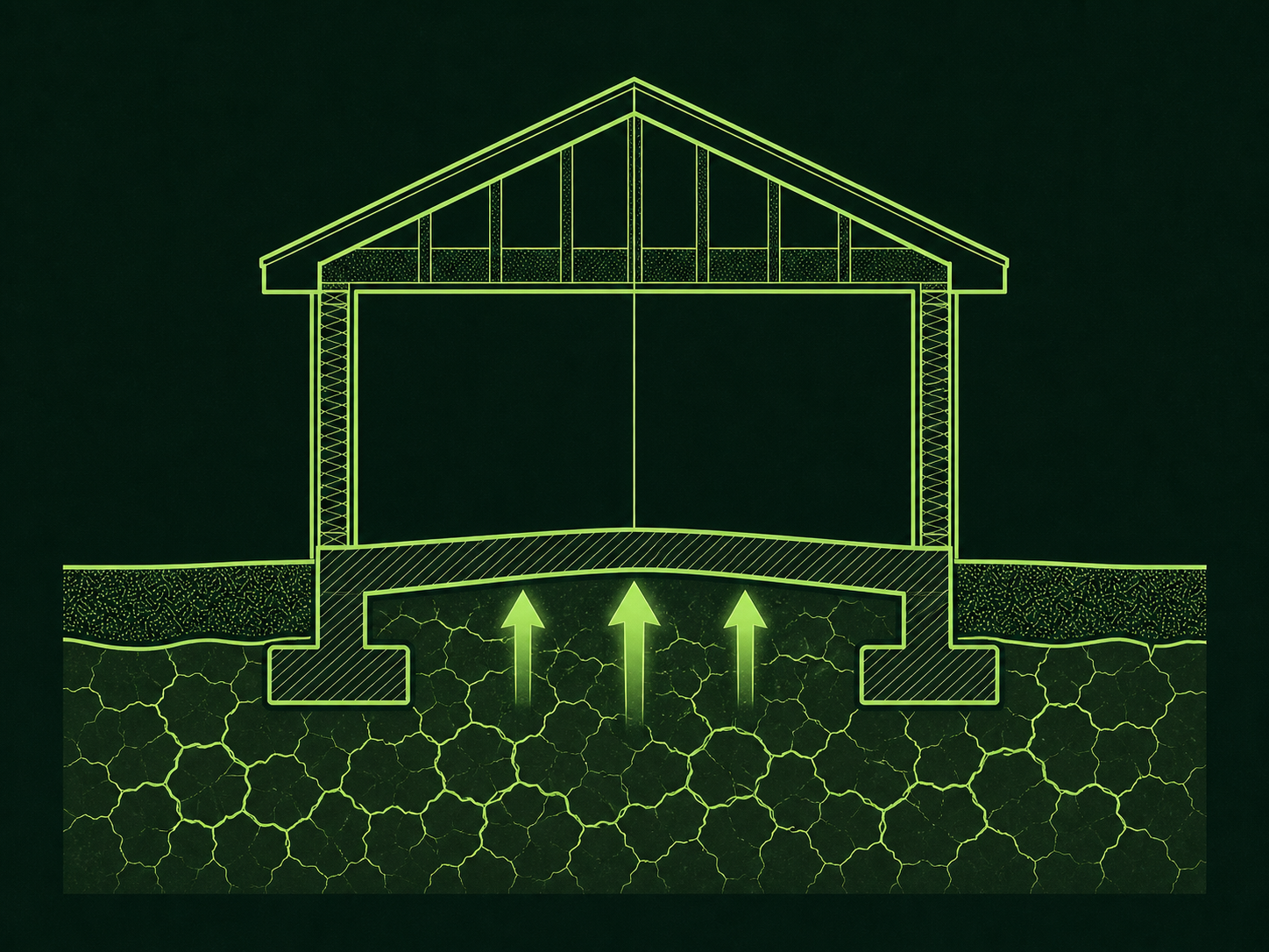
Swelling Upon Moisture Absorption
When rainfall returns, expansive clay minerals absorb water between lattice layers, expanding in volume and exerting pressure on surrounding soil.
What to notice: Water absorption closes shrinkage cracks and expands soil volume.
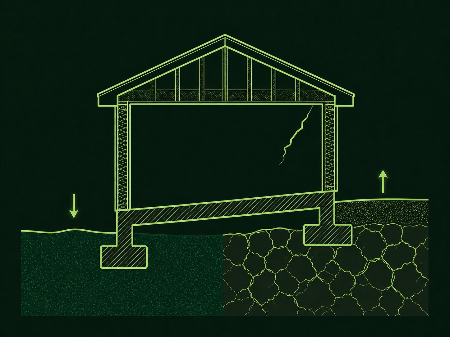
Cyclic Dimensional Change Across Seasons
Repeated wetting and drying cycles cause cyclic soil volume changes that can influence shallow slabs or pavement if moisture is uneven.
What to notice: Uneven soil moisture around foundations accentuates localized soil movement.
Linear Extensibility Potential (LEP %) Ranges
LEP measures soil linear dimensional change upon wetting and drying.
Key Takeaways
- LEP measures soil linear dimensional change upon wetting and drying.
- Expansive clays shrink during drought and swell when wet.
- Geotechnical soil testing is required before designing structural foundations.
Expansive Clay Behavior
Smectite clays expand and contract significantly with moisture changes.
Expansive soils contain clay minerals capable of absorbing water into their crystal lattice.
LEP measures soil volume change potential. It does not predict structural foundation failure on a specific building lot.
Official USDA Field Explanation: Linear Extensibility (LEP)
Linear Extensibility Potential (LEP %)
1. What is it? (Plain English)
The linear dimensional change of soil when it expands upon wetting and shrinks upon drying.
Technical definition: The linear expression of the volume change of soil material between the moist state and the dry state.
2. How USDA Reports This Field
chorizon.lep_rInterpretation Ranges & Rating Meanings
| Category / Level | Condition / Range | Physical Property Meaning |
|---|---|---|
| Low | < 3.0 % LEP | Low linear dimensional change upon wetting. |
| Moderate | 3.0 – 6.0 % LEP | Moderate linear dimensional change upon wetting. |
| High | 6.0 – 9.0 % LEP | High linear dimensional change upon wetting. |
| Very High | > 9.0 % LEP | Very high linear dimensional change upon wetting. |
3. Why it matters for soil evaluation
Screening indicator for expansive clay soils that exhibit dimensional change during wetting and drying cycles.
4. What This Field Does NOT Prove (Limitations)
- LEP is a soil property estimate, not a structural foundation failure diagnosis or crack prediction.
- Uneven moisture around a foundation (such as clogged gutters or localized irrigation) accentuates soil movement.
- On-site geotechnical soil testing is required before designing structural footings.
USDA soil survey data provides broad mapped screening information across soil polygons. Field conditions on individual building lots can vary due to past grading, excavation, or micro-topography. Always consult a licensed geotechnical engineer or soil scientist for on-site parcel decisions.
How LEP Appears in Subsurface Atlas Reports
Subsurface Atlas reports LEP percentages by horizon layer.
Property Relevance
Screening context for expansive soil movement potential.
Geotechnical soil borings and lab testing are required before foundation construction.
Survey Limitations & Notes
- LEP values are estimated across mapped survey polygons.
Common Myths vs. Reality
Proper site grading and foundation engineering successfully mitigate shrink-swell soil movement.
Primary Sources & References
Want to see what soil layers exist under your property?
Enter any U.S. address into Subsurface Atlas to explore mapped USDA soil units, components, drainage classes, and horizon profiles.
Run Address Lookup →