
Subsurface Restrictive Layers: Fragipans, Claypans, and Bedrock
Understand how underground restrictive layers stop plant roots, block water movement, and influence foundation excavation.
Restrictive layers are hard underground barriers like bedrock, dense claypans, or cemented fragipans that block root growth and stop downward water drainage.
Visualizing Subsurface Restrictive Barriers & Bedrock
This three-stage visual sequence illustrates dense soil pans, root restriction, and shallow bedrock contact layers.
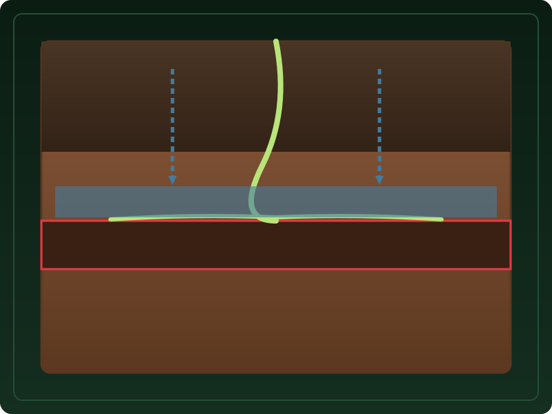
Dense Layers Intercept Water Movement
Dense claypans and fragipans create hard continuous barriers beneath upper soil horizons, slowing downward percolation.
What to notice: Downward water arrows divert laterally above the pan.
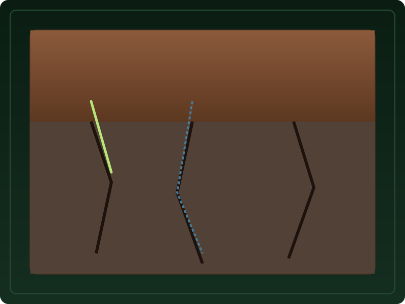
Weathered Rock Fractures Allow Limited Entry
Weathered rock horizons contain fracture networks where limited water and fine roots penetrate through existing cracks.
What to notice: Water and roots follow existing rock fracture lines.
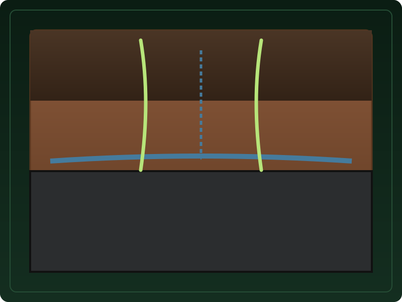
Continuous Hard Bedrock Contact
Solid unweathered bedrock (R horizon) forms a continuous restrictive contact that stops root growth and vertical water flow completely.
What to notice: Bedrock forms the bottom geological contact boundary.
Key Takeaways
- Restrictive layers include unweathered bedrock, dense fragipans, and compact claypans.
- Shallow restrictive layers block downward water flow, creating perched water tables.
- Mapped depths are estimates and do NOT serve as utility digging clearances.
Underground Barriers
Restrictive layers significantly impede the movement of water and roots.
Underground barriers alter subterranean drainage pathways and foundation digging feasibility.
Mapped restrictive layer depths represent survey screening estimates. They must never replace utility locate calls (811) or test pit borings.
Official USDA Field Explanation: Restrictive Layers
Subsurface Restrictive Layers & Bedrock
1. What is it? (Plain English)
Hard underground barriers (bedrock, fragipans, dense claypans) that impede root growth and water flow.
Technical definition: A nearly continuous layer that has one or more physical or chemical properties that significantly impede the movement of water or roots.
2. How USDA Reports This Field
corestrictindex.reskind3. Why it matters for soil evaluation
Provides screening context for foundation excavation difficulty, basement feasibility, and shallow perched water tables.
4. What This Field Does NOT Prove (Limitations)
- Mapped depth to bedrock is a survey estimate; unweathered rock ledges vary across short distances.
- NOT a digging clearance tool; does not replace utility call-outs or test pit borings.
USDA soil survey data provides broad mapped screening information across soil polygons. Field conditions on individual building lots can vary due to past grading, excavation, or micro-topography. Always consult a licensed geotechnical engineer or soil scientist for on-site parcel decisions.
How Restrictive Layers Appear in Subsurface Atlas Records
Subsurface Atlas reports restrictive layer types and estimated depths.
Property Relevance
Screening context for excavation difficulty and shallow perched water potential.
On-site geotechnical borings or test pits are required before building.
Survey Limitations & Notes
- Bedrock ledges and fragipans vary across short distances.
Common Myths vs. Reality
Subsurface bedrock surfaces are uneven; rock ledges can rise closer to the surface.
Primary Sources & References
Want to see what soil layers exist under your property?
Enter any U.S. address into Subsurface Atlas to explore mapped USDA soil units, components, drainage classes, and horizon profiles.
Run Address Lookup →